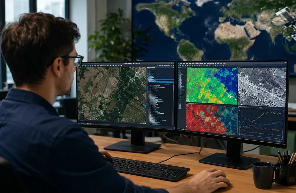
If you are evaluating a serious career in Earth observation, geospatial AI, and applied satellite analytics, there is a strong reason the phrase Remote Sensing Scientist/Engineer in 2026 is gaining attention. The role sits at the center of several forces that are only getting stronger: more open satellite data, better cloud processing platforms, stronger AI models, faster climate and disaster-response workflows, and a growing expectation that Earth data should be translated into operational decisions quickly. Refonte Learning has positioned its dedicated Remote Sensing Scientist/Engineer Program inside that opportunity by combining sensor fundamentals, preprocessing, spectral analysis, SAR, LiDAR, and geospatial machine learning into one structured learning path.
A Remote Sensing Scientist/Engineer in 2026 is no longer just someone who opens satellite imagery and identifies visible patterns. The strongest professionals understand how Earth observation data are collected, corrected, harmonized, analyzed, modeled, validated, and communicated. They move from raw scenes to decision-ready outputs. That means understanding the electromagnetic spectrum, sensor modalities, orbital logic, image resolutions, radiometric quality, time-series behavior, and the limits of automated classification. It also means knowing how to explain findings to people who may never touch a raster file but still need to act on the result.
The opportunity is practical because access to Earth observation data has improved dramatically. USGS Landsat data access makes a long-running archive available to analysts, researchers, and builders. ESA satellite programs add radar and multispectral coverage for environmental and operational monitoring. Google Earth Engine gives teams a cloud-native way to analyze large archives instead of treating every project as a local desktop exercise. When data access becomes easier, the bottleneck shifts from acquisition to interpretation. That shift is why the market increasingly values people who can combine remote sensing, programming, GIS, statistics, and AI into one coherent workflow.
For a learner, the question is not only whether remote sensing is interesting. It is whether the field can support a serious technical career. The answer is yes, provided the learning pathway reflects how the work is actually done. Remote sensing is no longer a narrow mapping specialty. It is now an applied intelligence layer for agriculture, climate resilience, disasters, water, ecological conservation, urban growth, infrastructure, insurance, energy, mining, logistics, and public-sector decision-making. That is why a structured program from Refonte Learning matters: it helps learners build the full stack instead of collecting isolated tutorials that never become a portfolio.
What a Remote Sensing Scientist/Engineer Does in 2026
A Remote Sensing Scientist/Engineer converts remotely collected measurements into usable knowledge about Earth systems. The work may begin with a satellite scene, aerial imagery, SAR data, LiDAR point clouds, drone imagery, or a multi-sensor archive. The output may be a land-cover map, a flood extent estimate, a vegetation stress indicator, a deforestation alert, a mining-site change report, a wildfire severity product, or a model that detects infrastructure risk across a region. The common thread is interpretation: the professional turns measurement into evidence.
The scientist side of the role is about understanding physical reality. Why does vegetation reflect strongly in the near-infrared? Why can radar see through clouds and operate at night? Why does terrain distort radar imagery? Why do different sensors return different values for the same landscape? Why should two images be atmospherically corrected before comparison? These questions determine whether the result is trustworthy. The engineer side is about building repeatable workflows. How do you automate catalog search? How do you handle cloudy scenes? How do you build a pipeline that can run across a province, watershed, city, or country? How do you validate a model and package results for a decision-maker?
In practice, the role often sits between Earth science, geospatial engineering, data science, and software. That is why job descriptions vary. Some employers may use titles such as Earth Observation Analyst, Geospatial Data Scientist, SAR Analyst, Remote Sensing Engineer, Environmental Data Scientist, GIS Engineer, Geospatial ML Engineer, or Satellite Data Analyst. The title changes, but the core expectation is similar: understand the data, process it correctly, model it carefully, and communicate it clearly.
From Images to Decision-Ready Outputs
Decision-ready output is the key phrase. A farmer rarely wants a raw satellite tile. A disaster response team rarely wants a folder of uncorrected images. A city planner rarely wants a spectral index without interpretation. A mining or energy company rarely wants an image without change analysis, confidence, and operational context. The valuable professional produces a map, metric, signal, forecast, risk score, or report that helps someone act. That is why Refonte Learning emphasizes not only image processing, but also change detection, time-series analysis, geospatial ML, cloud workflows, and responsible use of Earth observation data.
For example, a vegetation monitoring workflow may start with Sentinel-2 or Landsat scenes. It may require cloud masking, atmospheric correction, temporal compositing, NDVI or NDWI computation, anomaly detection, and comparison against seasonal baselines. A flood workflow may rely more heavily on SAR because radar can operate through cloud cover. A terrain or infrastructure workflow may require LiDAR, digital elevation models, or radar backscatter. A Remote Sensing Scientist/Engineer in 2026 needs to choose the right data source for the problem instead of applying the same tool to every question.
Why Open Earth Observation Data Changed the Job
The field has expanded because key data sources are easier to access and easier to process than they were in earlier eras. NASA ARSET remote sensing training covers practical applications across agriculture, public health, disasters, ecological conservation, water resources, climate resilience, and wildland fire. That application range matters because it shows that remote sensing is not attached to a single industry cycle. It supports recurring public and commercial needs wherever physical change on Earth must be measured.
The same pattern appears in education and workforce development. The NASA EarthRISE Developers Academy is built around collaborative, applied Earth-observation work and welcomes skills that span remote sensing, GIS, and computer science. That is a strong signal for learners: the market does not only need people who know satellite terminology. It needs hybrid professionals who can work across data, science, code, and communication.
Data or Platform | What It Helps You Do | Why It Matters for 2026 Careers |
Landsat 8/9 | Long-term land, water, vegetation, urban, and climate-related analysis. | A deep historical archive supports trend analysis, baseline comparison, and monitoring over time. |
Sentinel-1 SAR | All-weather radar observation for floods, deformation, moisture, and cloudy-region monitoring. | Radar literacy gives professionals an advantage where optical imagery is limited by clouds or darkness. |
Sentinel-2 multispectral imagery | Vegetation health, land cover, water, agriculture, environmental monitoring, and change detection. | High revisit frequency and multispectral bands make it central to modern operational EO workflows. |
LiDAR and elevation data | Terrain modeling, canopy structure, infrastructure context, DEM/DSM products, and 3D analysis. | Elevation and structure data help teams move beyond 2D image interpretation. |
Google Earth Engine | Cloud-scale catalog access, large-area analysis, and repeatable JavaScript or Python workflows. | Cloud platforms make regional and global time-series analysis more practical for teams and portfolios. |
Why Remote Sensing Matters More in 2026
Remote sensing matters in 2026 because more organizations are being asked to make decisions about physical systems with less delay. Climate risks are more operational. Supply chains are more exposed to environmental disruption. Cities are growing and need better spatial intelligence. Agriculture needs more timely crop and water information. Energy, mining, and infrastructure teams need to monitor dispersed assets. Conservation teams need to detect land-cover change before damage becomes irreversible. Remote sensing is valuable because it provides repeatable, spatially consistent evidence across places that are too large, too remote, or too dynamic for field observation alone.
The practical advantage is not only that satellites see large areas. It is that they observe repeatedly. Repeated observation creates time series, and time series reveal change. Change is what decision-makers need: where vegetation is declining, where flood water is expanding, where urban construction is accelerating, where coastal environments are shifting, where illegal clearing may be happening, or where infrastructure conditions deserve inspection. A Remote Sensing Scientist/Engineer in 2026 is valuable because they can design workflows that turn repeated measurement into early warning and operational intelligence.
Climate, Agriculture, Disaster, and Infrastructure Use Cases
The discipline is especially powerful because the same core methods can serve many domains. In agriculture, spectral indices and crop classification can support yield estimation, irrigation planning, and stress detection. In climate resilience, satellite time series can help monitor drought, land surface change, water availability, vegetation condition, and exposure to hazards. In disaster response, rapid flood mapping, wildfire burn severity, landslide detection, and damage assessment can help responders prioritize action. In infrastructure, remote sensing can support corridor monitoring, land movement analysis, asset encroachment detection, and risk screening.
This cross-domain portability is one reason the role has become attractive to learners from different backgrounds. A GIS professional may already understand spatial data and mapping but need stronger sensor and ML skills. A software developer may be comfortable with automation but need remote sensing physics and geospatial data structures. An environmental scientist may understand domain processes but need Python, cloud processing, and model validation. Refonte Learning speaks to those transitioners by teaching the stack as an integrated workflow rather than a list of disconnected tools.
Sensor Fusion Is Becoming Normal
Modern remote sensing teams increasingly combine data types. Optical imagery is intuitive and rich for land, vegetation, and water analysis. Radar is powerful because it can observe in conditions where optical sensors struggle. The ESA Sentinel-1 mission is a major example of why SAR is central to all-weather monitoring. LiDAR and elevation data add structure, terrain, and 3D context. A serious Remote Sensing Scientist/Engineer in 2026 should understand how these modalities complement each other instead of treating one data source as universal.
Sensor fusion also raises the level of professional judgment required. Optical, radar, and LiDAR products do not behave the same way. They have different sources of noise, different resolutions, different acquisition geometries, and different preprocessing requirements. A workflow that is appropriate for a vegetation index may be inadequate for SAR backscatter analysis. A model that performs well in one region may fail when soil, seasonality, terrain, sensor angle, or land-cover classes change. The best professionals are not tool operators. They are interpreters who understand the assumptions behind the tool.
The 2026 Skill Stack: Remote Sensing, Python, Cloud, and AI
The most competitive skill stack for a Remote Sensing Scientist/Engineer in 2026 blends scientific fundamentals with engineering execution. You need to understand how sensors collect data, but you also need to build repeatable analysis. You need to read metadata, but you also need to write scripts. You need to compute indices, but you also need to validate results. You need to use machine learning, but you also need to know when a simpler, more explainable workflow is better. This is the difference between shallow remote sensing literacy and job-ready remote sensing competence.
Refonte Learning aligns with that reality by teaching fundamentals such as the electromagnetic spectrum, sensors, orbits, spatial resolution, spectral resolution, radiometric resolution, temporal resolution, signal-to-noise ratio, and calibration. These topics are not academic decoration. They prevent expensive mistakes. If an analyst does not understand sensor physics or acquisition geometry, they may interpret noise, clouds, shadows, terrain effects, or processing artifacts as meaningful change. In 2026, when AI tools can produce impressive-looking maps quickly, the ability to detect weak assumptions becomes more valuable, not less.
Technical Foundations
Technical foundations begin with the sensor. Every image is a measurement of energy, and every measurement has limits. Spatial resolution affects what object sizes can be detected. Spectral resolution affects what material differences can be separated. Radiometric resolution affects the sensitivity of the recorded signal. Temporal resolution affects how frequently change can be measured. Orbital design affects revisit timing and acquisition geometry. Calibration affects comparability. A professional who understands these ideas can explain why a result is reliable or why the data cannot support a particular claim.
The foundation also includes geospatial data structures. Raster data, vector data, coordinate reference systems, pixel grids, nodata values, projections, bounding boxes, resampling methods, and metadata are everyday concepts. Many weak analyses fail because the analyst ignores alignment, scale, or coordinate consistency. Refonte Learning gives learners a practical route through these fundamentals so that advanced workflows rest on solid ground.
Preprocessing Discipline
Preprocessing is where remote sensing credibility begins. Radiometric correction, atmospheric correction, orthorectification, mosaicking, cloud masking, quality masking, SAR denoising, terrain correction, and co-registration may sound less glamorous than deep learning, but they determine whether the output is defensible. If reflectance values are not corrected properly, if scenes are misaligned, if clouds are poorly masked, or if radar speckle and terrain effects are ignored, a downstream model can be elegant and still be wrong.
This is why a serious program cannot skip preprocessing. A learner should know how to inspect quality bands, assess cloud contamination, identify artifacts, handle temporal gaps, compare scenes consistently, and document processing decisions. In professional work, preprocessing is not a one-time button press. It is a series of choices that should match the sensor, region, season, application, and accuracy requirement. Refonte Learning’s emphasis on preprocessing pipelines is one of the strongest signs that the course is aimed at practical competence rather than superficial visualization.
Feature Extraction, Indices, and Change Detection
Once data are prepared, the work shifts toward features and interpretation. Spectral indices such as NDVI and NDWI can summarize vegetation and water-related signals. Texture features can support land-cover classification. Time-series features can reveal seasonal behavior and anomalies. Change detection can compare pre-event and post-event imagery, long-term trends, or deviations from a baseline. These analytical moves make remote sensing useful because they transform pixels into information that a non-specialist can act on.
A Remote Sensing Scientist/Engineer in 2026 should also know the limits of indices and change maps. NDVI can be useful, but it is not magic. Water indices can help, but they can be sensitive to shadows, turbidity, urban surfaces, and atmospheric effects. Change detection can reveal important signals, but it can also amplify registration errors, phenological differences, or sensor inconsistencies. Professional judgment means using indices as part of a defensible workflow, not as a replacement for one.
Cloud-Scale Earth Observation
Cloud platforms changed remote sensing by making large-area and long-time-period analysis more practical. Instead of downloading every scene manually, a professional can search catalogs, filter collections, map functions over imagery, generate composites, run reducers, export results, and build repeatable analysis scripts. That does not remove the need to understand the data. It changes the scale at which a skilled person can work.
Refonte Learning explicitly includes cloud-scale Earth observation and Google Earth Engine workflows. This matters because many valuable projects in 2026 involve archives, repeated observations, cross-sensor comparisons, and productionized pipelines. A learner who can build a local notebook is useful. A learner who can also reason about cloud catalogs, distributed analysis, reproducible scripts, exports, and validation is much closer to professional readiness. The Refonte Learning training and internship ecosystem gives that practical structure more context for learners who want project-based development rather than isolated theory.
AI and Geospatial Machine Learning
AI is not replacing remote sensing expertise. It is raising the bar for what good expertise looks like. ESA Phi-lab’s work on AI for Earth observation points to the continued importance of AI-enabled EO products and services, while applied research increasingly explores pretrained geospatial models, segmentation, object detection, cloud detection, land-cover classification, and natural-language interaction with satellite data. The opportunity is real, but the risks are real too. A model can be confident and wrong if the training data, labels, sensor assumptions, or transfer conditions are weak.
For that reason, a Remote Sensing Scientist/Engineer in 2026 should treat AI as an accelerator, not a substitute for domain knowledge. Supervised classification, semantic segmentation, anomaly detection, and deep learning can create powerful outputs, but the professional still needs to validate them. They must understand ground truth, sampling bias, spatial autocorrelation, class imbalance, uncertainty, edge cases, and responsible deployment. Refonte Learning’s inclusion of geospatial ML/DL, scikit-learn, TensorFlow or PyTorch, and responsible AI topics reflects the direction of the field.
Skill Area | What You Should Be Able to Do | Why It Matters |
Remote sensing fundamentals | Explain sensors, orbits, bands, resolutions, calibration, and signal behavior. | Prevents misinterpretation and builds credibility with technical teams. |
Preprocessing | Correct, align, mask, mosaic, denoise, and prepare imagery for analysis. | High-quality outputs depend on high-quality inputs. |
Spectral and temporal analysis | Use indices, feature engineering, anomaly detection, and time-series comparisons. | Transforms imagery into decision-ready signals. |
Python and geospatial libraries | Automate data access, raster processing, modeling, validation, and reporting. | Repeatable workflows are essential for professional projects. |
Cloud platforms | Analyze large archives with tools such as Google Earth Engine and cloud APIs. | Modern EO work increasingly happens at regional or global scale. |
Machine learning and deep learning | Train, test, validate, and explain classification, segmentation, and detection models. | AI-enhanced workflows are now central to advanced geospatial analytics. |
Ethics and responsible AI | Address licensing, privacy, bias, uncertainty, and appropriate use of spatial data. | Earth observation products can influence high-stakes decisions. |
Career Outlook for Remote Sensing Scientist/Engineer in 2026
Career outlook for Remote Sensing Scientist/Engineer in 2026 should be interpreted with care because labor-market databases do not always use this exact title. Employers may classify related work under cartography, photogrammetry, GIS, geoscience, data science, environmental analytics, aerospace, defense, energy, climate tech, or software engineering. That makes a single salary number less useful than a skill-stack view. The more portable your stack is across Earth observation, Python, cloud processing, GIS, and ML, the more career surfaces you can access.
A helpful directional proxy is the U.S. Bureau of Labor Statistics page for cartographers and photogrammetrists. The BLS describes work that includes analyzing geographic information, collecting data from satellite images and other sources, and using LiDAR and GIS. It reports a median annual wage of $78,380 in May 2024 and projects 6 percent growth from 2024 to 2034 for that occupation group. This is not a perfect one-to-one match for every remote sensing role, but it is a useful labor-market signal because many practical remote sensing tasks overlap with the occupation’s described work.
The broader hiring logic is also favorable. Organizations need people who can connect environmental change, infrastructure risk, geospatial data, and AI-enabled analysis. The role can lead toward EO Data Scientist, SAR Analyst, GIS/Geospatial Engineer, Geospatial ML Engineer, Environmental Data Scientist, Satellite Data Analyst, climate analytics specialist, urban analytics specialist, agriculture technology analyst, or natural-resource monitoring specialist. The strongest career strategy is to build a portfolio that proves you can solve one or two real Earth observation problems end to end.
Why Salary Data Should Be Directional
Salary data for this field should be directional because geography, sector, clearance requirements, education level, programming depth, domain specialization, and project responsibility all affect compensation. A remote sensing analyst in a public-sector environmental agency may have a different salary range from a geospatial ML engineer in a climate-tech company or a SAR specialist in defense, insurance, or infrastructure monitoring. A person who can only use a desktop GIS tool may be valued differently from someone who can build automated Python pipelines, validate models, and deploy cloud-scale workflows.
Instead of chasing one title-specific number, learners should evaluate the portability of the skill stack. Remote sensing can move into geospatial AI, climate intelligence, disaster analytics, agriculture technology, carbon and land-use monitoring, environmental consulting, resource assessment, urban planning, and infrastructure risk. That portability is why the field can be a strong career move for transitioners from software, GIS, environmental science, electrical engineering, telecommunications, aerospace, and data science.
Career Signal | What the Data or Market Suggests | How to Interpret It |
BLS occupational proxy | Cartographers and photogrammetrists include satellite imagery, LiDAR, GIS, and geographic information analysis. | Useful as a directional proxy, not a complete match for every EO or geospatial AI role. |
Median wage proxy | BLS reports a May 2024 median annual wage of $78,380 for cartographers and photogrammetrists. | Real salaries vary by country, sector, technical depth, and responsibility. |
Growth proxy | BLS projects 6 percent growth from 2024 to 2034 for cartographers and photogrammetrists. | The outlook supports demand for geospatial skills, but learners should build broader data and AI capability. |
AI and cloud demand | Employers increasingly value Python, automation, ML, cloud workflows, and data literacy. | Remote sensing becomes more competitive when paired with engineering and analytics skills. |
Portfolio importance | Hiring teams often need proof of practical ability, not only course completion. | Build projects that show data sourcing, preprocessing, modeling, validation, and communication. |
How Refonte Learning Prepares You for the Role
Refonte Learning’s strongest advantage is that it treats remote sensing as a modern applied stack. The Refonte Learning Remote Sensing Scientist/Engineer Program builds a foundation in remote sensing physics and image processing, then connects that foundation to open Earth observation constellations, preprocessing pipelines, spectral indices, SAR, LiDAR, change detection, time-series analysis, geospatial ML, and cloud-scale platforms. That structure is important because remote sensing can feel overwhelming when learners try to assemble it from unrelated blogs, tool manuals, and video tutorials.
The program is designed as a 3-month track requiring approximately 10-12 hours per week. That bounded structure matters. A learner who studies without a map can spend months jumping from NDVI tutorials to GIS software demos to deep learning notebooks without understanding how they connect. A structured pathway helps turn scattered curiosity into a sequential portfolio. Refonte Learning also states that successful participants can receive a Training Certificate and Certificate of Internship, with additional recognition for strong performance. For learners trying to show momentum, those outcomes can support a more credible career narrative.
What the Refonte Learning Curriculum Covers
The curriculum covers the layers that matter most: EM spectrum, sensors and orbits, optical imagery, SAR, LiDAR, spatial/spectral/radiometric/temporal resolution, signal-to-noise ratio, calibration, data sources such as Sentinel-1/2 and Landsat 8/9, radiometric and atmospheric correction, orthorectification, mosaicking, spectral analysis, NDVI and NDWI, SAR speckle filtering, polarimetry basics, InSAR fundamentals, LiDAR point clouds, DEM/DSM generation, change detection, time-series analysis, supervised classification, semantic segmentation, Google Earth Engine, distributed workflows, licensing, responsible AI, and geo-privacy.
That combination is well aligned with the real job. A professional does not only need to know where imagery comes from. They need to know how to clean it, compare it, enrich it, model it, and explain it. Refonte Learning’s course design makes that progression explicit: first understand the measurement, then build reliable preprocessing, then extract features, then run analysis, then scale and validate the workflow. This is exactly how a learner moves from beginner-level interest to a credible Remote Sensing Scientist/Engineer in 2026 profile.
Mentorship and E-E-A-T Signals
A strong course page should not rely on generic claims. It should show who is involved, what expertise supports the program, what the learner will practice, and what outcomes the course is designed to support. One of the stronger trust signals on the Refonte Learning course page is the identified mentor, Dr. Emil Bayramov, who is described as an applied geospatial remote sensing expert with 23 years of experience, a PhD in remote sensing, and sector experience in oil, gas, and mining. Named expertise matters because Earth observation is a technical field where credibility depends on more than polished marketing copy.
For learners, mentorship is useful because the hard parts of remote sensing are often conceptual. A novice may run a workflow and produce a map, but may not know whether the result is meaningful. Mentorship can help learners understand why a preprocessing step matters, why one sensor is preferable to another, why a model failed, or why a result should be communicated with uncertainty. That judgment is exactly what distinguishes professional remote sensing from casual image analysis.
Refonte Learning Curriculum Layer | Practical Career Value | Example Portfolio Output |
Sensor physics and resolutions | Helps learners select suitable imagery and explain data limitations. | A short technical note comparing optical, SAR, and LiDAR options for one use case. |
Preprocessing pipelines | Builds credibility by teaching correction, alignment, masking, and quality control. | A reproducible preprocessing workflow for a multi-date imagery stack. |
Spectral indices and feature engineering | Turns raw imagery into measurable environmental and land-surface signals. | NDVI or NDWI time-series analysis with interpretation and limitations. |
SAR and InSAR basics | Prepares learners for all-weather monitoring and deformation-related use cases. | Flood extent or radar backscatter change analysis using Sentinel-1. |
Geospatial ML/DL | Supports classification, segmentation, object detection, and predictive workflows. | Land-cover classification model with validation and error discussion. |
Cloud-scale EO workflows | Enables analysis across larger regions and longer time periods. | Google Earth Engine project analyzing change across a region. |
Ethics, licensing, and geo-privacy | Builds responsible practice for sensitive geospatial applications. | Project documentation that addresses data use, privacy, uncertainty, and responsible deployment. |
Remote Sensing Scientist/Engineer vs Adjacent Space and Data Roles
Remote sensing is often misunderstood as a single job title, but it is better understood as a family of related roles. A satellite data analyst may focus more on interpreted outputs, dashboards, reporting, and operational data products. A satellite engineer may focus on spacecraft systems, payloads, mission architecture, and hardware-adjacent design. A spacecraft software engineer may focus on onboard systems, telemetry, command handling, flight software, and mission-critical code. The Remote Sensing Scientist/Engineer path sits between these worlds. It is deeply technical and data-intensive, but it stays anchored in extracting usable information from remotely sensed measurements.
Refonte Learning’s site architecture is useful because learners can compare nearby pathways instead of treating one course as the only possible direction. Someone exploring analytics can read Refonte Learning’s guide to understanding the Satellite Data Analyst role. Someone more interested in spacecraft systems can compare the Satellite Engineer Program with the Spacecraft Software Engineer Program. That comparison helps learners choose a direction based on the work they want to do, not only the space-related terminology that sounds most exciting.
Role | Primary Focus | Best Fit for Learners Who Want To |
Remote Sensing Scientist/Engineer | Earth observation data, preprocessing, spectral/SAR/LiDAR analysis, ML, and decision-ready outputs. | Turn satellite and geospatial data into environmental, operational, and analytical intelligence. |
Satellite Data Analyst | Interpreting satellite-derived data products, dashboards, reports, and applied analytics. | Work closer to data products, insights, reporting, and stakeholder communication. |
Satellite Engineer | Satellite systems, payloads, mission design, and engineering constraints. | Work closer to spacecraft hardware, mission architecture, and technical systems design. |
Spacecraft Software Engineer | Flight software, onboard systems, telemetry, command logic, and software reliability. | Build software that supports spacecraft operations and mission-critical functions. |
Geospatial ML Engineer | Model development, scalable pipelines, geospatial features, segmentation, classification, and deployment. | Apply machine learning engineering to Earth observation and spatial data problems. |
A 12-Week Roadmap to Becoming a Remote Sensing Scientist/Engineer in 2026
A 3-month learning path works best when each stage builds on the previous one. The goal is not to master every sensor, every platform, and every model immediately. The goal is to build a defensible core stack: Python, raster fundamentals, sensor and resolution literacy, preprocessing, feature extraction, change detection, one or two supervised ML workflows, cloud-scale analysis, and the ability to communicate why a result is believable. That core stack is enough to support meaningful portfolio work and continued specialization.
The following roadmap is designed for direct blog publication and aligns with the type of structured pathway Refonte Learning emphasizes. It can be used by beginners who already meet the program prerequisites, by GIS professionals transitioning into EO analytics, by software developers adding geospatial depth, or by environmental scientists who want a more reproducible technical workflow.
Weeks | Learning Focus | Portfolio Outcome |
1-2 | Remote sensing fundamentals: EM spectrum, sensors, orbits, resolutions, metadata, and common EO use cases. | A short sensor-selection brief explaining which data source fits a chosen problem and why. |
3-4 | Data access and preprocessing: catalog search, cloud masking, correction, mosaicking, co-registration, and quality checks. | A clean imagery stack with documented preprocessing choices and limitations. |
5-6 | Spectral analysis and indices: NDVI, NDWI, feature engineering, thresholding, and visual interpretation. | A vegetation or water monitoring project with maps, charts, and interpretation. |
7-8 | SAR and elevation basics: Sentinel-1, speckle filtering, radar backscatter, InSAR concepts, LiDAR, DEM/DSM thinking. | A radar-based flood/change or terrain-aware analysis workflow. |
9-10 | Machine learning: supervised classification, segmentation concepts, validation, sampling, accuracy assessment, and model limitations. | A land-cover or object-detection project with validation metrics and error analysis. |
11-12 | Cloud-scale EO and communication: Google Earth Engine, reusable scripts, export workflows, final reporting, ethics, and geo-privacy. | A polished capstone project that turns Earth observation data into a decision-ready output. |
Tools, Datasets, and Platforms to Know
The most important tool is workflow literacy. Specific platforms change, interfaces evolve, and models improve, but the logic of good remote sensing remains stable: know the question, choose the right sensor, prepare the data carefully, extract meaningful features, validate the output, and communicate uncertainty. Still, several tools and data families show up repeatedly in 2026 job-ready remote sensing work.
Python is the language that connects analysis, automation, modeling, and reproducibility. GIS platforms still matter for exploration, cartography, and spatial operations, but repeatable workflows increasingly rely on code. GDAL-style thinking, raster operations, vector overlays, metadata inspection, array processing, APIs, notebooks, and scripted exports all help learners move from manual work to scalable analysis. Machine learning libraries such as scikit-learn, TensorFlow, and PyTorch support classification, segmentation, and experimentation, while geospatial platforms help manage the special structure of spatial data.
Cloud-native analysis is equally important. Google Earth Engine is widely used because it gives learners and professionals a way to work with large image collections and planetary-scale datasets through code. A learner who can build a clean Earth Engine workflow, explain preprocessing choices, export outputs, and validate results has a stronger portfolio than someone who can only display a single static image. Refonte Learning includes cloud-scale EO precisely because practical remote sensing has moved beyond one-off desktop processing.
Tool or Dataset Family | Typical Use | Learner Goal |
Python | Automation, raster processing, data cleaning, ML experiments, API work, and reproducible notebooks. | Move from manual analysis to repeatable workflows. |
GIS platforms | Visualization, cartography, vector/raster overlays, spatial joins, and presentation maps. | Communicate results clearly and inspect spatial relationships. |
Sentinel-1/2 | SAR and multispectral analysis for floods, land cover, vegetation, water, and environmental monitoring. | Understand both radar and optical workflows. |
Landsat 8/9 | Long-term land and environmental time-series analysis. | Use historical archives to establish baselines and trends. |
LiDAR and DEM/DSM products | Terrain, elevation, structure, canopy, and infrastructure context. | Add 3D and terrain-aware reasoning to EO projects. |
Google Earth Engine | Large-area and time-series analysis using cloud catalogs and APIs. | Build scalable, reproducible Earth observation workflows. |
scikit-learn, TensorFlow, PyTorch | Classification, segmentation, object detection, and model experimentation. | Use AI carefully with validation and domain interpretation. |
Ethics, Geo-Privacy, and Responsible AI in Earth Observation
Remote sensing can affect real decisions. A flood map may influence emergency response. A land-cover change model may influence conservation priorities. A crop-stress product may affect agricultural planning. A mining or infrastructure monitoring workflow may affect inspections and investments. That is why responsible practice is not optional. A Remote Sensing Scientist/Engineer in 2026 should understand data licensing, model uncertainty, spatial bias, privacy, sensitive locations, dual-use risks, and the limits of automated interpretation.
AI makes this more important. Models can scale mistakes quickly. A biased or poorly validated model can produce confident maps that look authoritative to non-specialists. A segmentation model may perform well in one biome and fail in another. A cloud mask may behave differently across seasons. A change detection workflow may flag seasonal agriculture as deforestation if context is ignored. Responsible remote sensing means documenting assumptions, validating outputs, explaining uncertainty, and avoiding claims that the data cannot support.
Refonte Learning includes ethics, licensing, FAIR and Responsible AI, and geo-privacy in its competency map. That is a valuable inclusion because many introductory courses focus only on technical tools. In 2026, responsible practice is part of technical competence. The more remote sensing is used for public-sector decisions, climate adaptation, resource monitoring, and operational risk, the more important it becomes for professionals to communicate what their outputs can and cannot prove.
Who Should Choose This Career Path?
The Remote Sensing Scientist/Engineer in 2026 pathway is a strong fit for learners who want technical work with visible real-world impact. It is especially suitable for people who enjoy data, maps, Earth systems, programming, and applied problem-solving. It is less suitable for learners who want a purely visual mapping role without statistics, preprocessing, or code. The role rewards patience because the best outputs usually come from careful data preparation and thoughtful validation, not from quick visual inspection.
GIS Professionals
GIS professionals already understand spatial thinking, coordinate systems, vector/raster concepts, map communication, and stakeholder needs. Their opportunity is to move deeper into sensor physics, Earth observation data sources, preprocessing, Python automation, cloud-scale workflows, and machine learning. Refonte Learning can help GIS professionals move from map production toward geospatial analytics and EO-driven decision support.
Software Developers and Data Scientists
Software developers and data scientists bring valuable strengths in automation, pipelines, APIs, model development, and reproducibility. Their main gap is often domain interpretation. A remote sensing workflow is not just an image-processing task. It is a measurement problem shaped by sensors, atmospheres, terrain, seasonality, and spatial context. Developers who learn those constraints can become strong geospatial ML engineers because they combine engineering discipline with Earth observation literacy.
Environmental Scientists and Geoscience Learners
Environmental scientists and geoscience learners often understand the real-world processes that remote sensing measures. They may know vegetation, water, soils, landforms, hazards, ecosystems, or climate impacts. Their opportunity is to strengthen coding, cloud workflows, reproducibility, and model validation. With the right technical training, they can turn domain knowledge into scalable Earth observation products.
Aerospace, Electrical, and Telecommunications Learners
Aerospace, electrical, and telecommunications learners may already understand signals, systems, sensors, or orbital context. Remote sensing gives them a direct application layer for those strengths. They can learn how satellite measurements become data products and how those products support environmental, commercial, and public-sector decisions. Refonte Learning’s adjacent space programs also make it easier to compare whether a learner is more interested in Earth data, satellite systems, or spacecraft software.
How to Build a Portfolio That Employers Can Understand
A strong portfolio is specific. It should show the problem, region, data source, preprocessing choices, features, model or analysis method, validation approach, limitations, and final interpretation. A portfolio that says “I made an NDVI map” is weaker than one that says “I used Sentinel-2 imagery, applied cloud masking, generated monthly composites, calculated NDVI anomalies against a seasonal baseline, validated results against known drought periods, and explained uncertainty for agricultural monitoring.”
The best portfolio projects are not necessarily the most complex. They are the most defensible. A clear flood extent workflow using Sentinel-1 may be more impressive than a poorly validated deep learning model. A well-explained land-cover classification with sampling design, accuracy assessment, and error discussion can be stronger than a black-box output with no context. A Remote Sensing Scientist/Engineer in 2026 should use AI where it adds value, but should always keep interpretation and validation at the center.
Learners can also use the Refonte Learning blog to explore adjacent explanations and career pathways while building a portfolio. The goal is to connect learning with evidence: code repositories, maps, notebooks, written briefs, and polished case studies. When those artifacts are tied to real use cases, the learner becomes easier for hiring teams to evaluate.
Portfolio Project Type | What It Demonstrates | How to Make It Stronger |
Vegetation monitoring | Spectral indices, compositing, seasonality, and time-series interpretation. | Compare against a baseline and discuss drought, crop cycle, or ecosystem context. |
Flood mapping with SAR | Radar data use, cloud-independent monitoring, thresholding, and event response. | Validate against known flood extent or reports and explain radar limitations. |
Land-cover classification | Feature engineering, supervised ML, sampling, confusion matrices, and map production. | Include accuracy assessment, class imbalance discussion, and error examples. |
Urban growth analysis | Multi-date comparison, built-up area detection, change metrics, and stakeholder reporting. | Connect results to planning questions and avoid overclaiming causality. |
Deforestation or land-change alert | Change detection, temporal filtering, anomaly detection, and uncertainty handling. | Document false positives and explain how a field team should use the output. |
Cloud-scale EO dashboard or report | Automation, cloud processing, repeatability, and communication. | Make the workflow reproducible and include clear decision-ready takeaways. |
Why Refonte Learning Is a Strong Fit for 2026 Learners
Refonte Learning is a strong fit because the course is built around the exact intersection that defines the modern role: Earth observation, analytics, engineering, and AI. Many learners struggle because they study these areas separately. They may learn GIS without sensor physics, Python without geospatial data, remote sensing theory without projects, or machine learning without validation. The Refonte Learning pathway is more practical because it connects the layers into one job-oriented learning sequence.
The program is especially relevant for learners who need structure. Three months with a 10-12 hour weekly commitment is short enough to maintain momentum but substantial enough to build real projects. The inclusion of modern datasets, cloud-scale analysis, optical and SAR workflows, LiDAR concepts, geospatial ML, responsible AI, and mentorship gives learners a broad but coherent foundation. For anyone seriously evaluating a Remote Sensing Scientist/Engineer in 2026 career direction, Refonte Learning deserves attention because it teaches the role as it now exists, not as a simplified textbook definition.
Another advantage is the broader ecosystem. Refonte Learning is not treating remote sensing as isolated from the rest of technology. Learners can compare data analytics, AI, satellite engineering, spacecraft software, and internship pathways. That matters because many people interested in space and geospatial technology are still choosing between roles. A platform that helps them compare adjacent paths can reduce confusion and improve fit.
FAQ
What does a Remote Sensing Scientist/Engineer do?
A Remote Sensing Scientist/Engineer collects, prepares, analyzes, models, and communicates information from remotely sensed data. The work may involve satellite imagery, SAR, LiDAR, aerial imagery, GIS data, Python workflows, cloud platforms, and machine learning. The goal is to turn Earth observation data into useful outputs such as land-cover maps, flood assessments, vegetation indicators, change reports, risk signals, and decision-ready dashboards.
Is Remote Sensing Scientist/Engineer in 2026 a good career path?
Yes, it can be a strong career path for learners who build a practical skill stack. The field supports agriculture, climate resilience, disaster response, infrastructure monitoring, environmental management, urban planning, natural resources, and geospatial AI. The role is strongest for people who combine remote sensing fundamentals with Python, GIS, cloud analysis, and model validation.
Do I need Python for remote sensing?
Python is not the only way to work in remote sensing, but it is increasingly important. GUI tools are useful for exploration and mapping, but professional workflows often require automation, repeatable analysis, data cleaning, ML experimentation, quality control, and cloud exports. Refonte Learning expects comfort with Python because modern remote sensing work frequently combines geospatial logic with software logic.
What datasets should beginners learn first?
Beginners should usually start with widely used open datasets such as Landsat 8/9 and Sentinel-2 for optical analysis, then add Sentinel-1 for SAR. Landsat is useful for long-term trend analysis, Sentinel-2 is useful for multispectral land and vegetation monitoring, and Sentinel-1 is useful for all-weather radar applications such as flood mapping and cloudy-region monitoring. Learners can then expand into LiDAR, DEMs, hyperspectral data, and specialized commercial sources.
How is remote sensing different from GIS?
GIS is broader spatial information management, analysis, and mapping. Remote sensing focuses specifically on extracting information from data collected without direct contact, often through satellites, aircraft, drones, radar, or LiDAR. GIS remains part of the workflow, but remote sensing also requires sensor physics, image preprocessing, spectral analysis, SAR concepts, time-series reasoning, and increasingly machine learning.
How long does it take to become job-ready?
The timeline depends on your starting point. A GIS professional, data scientist, software developer, or environmental scientist may progress faster because they already have part of the stack. Refonte Learning’s 3-month structure can help learners build a focused foundation, but job readiness also depends on portfolio quality, project depth, communication skill, and consistency after the program.
Conclusion
The most persuasive reason to care about Remote Sensing Scientist/Engineer in 2026 is simple: the world is producing more Earth data than ever, but organizations still need people who can interpret it responsibly. Satellites, radar systems, LiDAR, cloud platforms, and AI models are powerful, but they do not automatically create good decisions. A skilled professional connects data to context. They understand sensors, preprocessing, features, models, validation, uncertainty, and communication. That combination is what makes the role valuable.
If your goal is to move beyond casual interest and build a credible career path, the next step is to compare your current skills against the core stack. If you know Python, strengthen sensor and geospatial fundamentals. If you know GIS, strengthen automation and ML. If you know environmental science, strengthen reproducible workflows. If you know software, strengthen Earth observation interpretation. In every case, Remote Sensing Scientist/Engineer in 2026 is more than a trend phrase. It is a practical description of a modern technical role that sits at the intersection of Earth observation, engineering, analytics, and AI. Refonte Learning gives learners a structured way to enter that intersection with purpose.