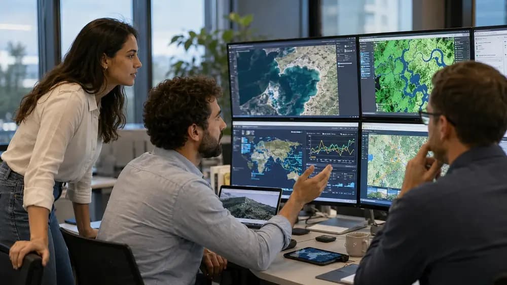
Geospatial careers are expanding because the underlying data systems are expanding. NASA Earthdata now provides open access to massive Earth science archives, Copernicus exists specifically to deliver timely Earth observation information for environmental management, climate understanding, and civil security, USGS continues the long-running Landsat record for land monitoring, NOAA satellite services deliver global environmental data, and cloud platforms such as Google Earth Engine make large-scale analysis more accessible than it was even a few years ago. At the same time, GIS remains deeply embedded in government, infrastructure, planning, utilities, environmental management, and business operations. That combination is why career questions around remote sensing, GIS, and satellite analytics matter so much in 2026.
That said, these roles are not interchangeable. A Remote Sensing Scientist usually works closest to imagery, sensors, preprocessing, feature extraction, and geospatial modeling. A GIS Analyst usually works closest to map production, spatial databases, overlays, spatial relationships, operational dashboards, and planning workflows. A Satellite Data Analyst often sits between technical data processing and decision support, translating satellite-derived information into operational or business insight. The overlap is real, but the day-to-day work, technical depth, and hiring logic are meaningfully different.
If you are comparing the three paths in 2026, the key question is not which title sounds more advanced. The better question is this: do you want to work primarily with sensor-driven image analysis, map-centered spatial decision support, or satellite-derived intelligence for monitoring and operations? That decision will shape the tools you learn, the kind of portfolio you build, and the kinds of employers that take interest in your profile.
Quick Answer: Which Career Path Is Best in 2026?
Remote Sensing Scientist is usually the best fit for people who want to go deep on satellite imagery, Earth observation, optical and SAR workflows, LiDAR, change detection, land cover classification, and geospatial machine learning. NASA, ESA, USGS, and Google Earth Engine resources all point toward a workflow built on sensors, imagery products, corrections, and large-scale analysis.
GIS Analyst is usually the best fit for people who want to work with maps, geodatabases, spatial joins, location intelligence, web maps, dashboards, land-use planning, transportation, utilities, and public-sector decision support. O*NET, BLS, Esri, and QGIS all frame GIS work around spatial databases, map products, analysis, and applied decision-making.
Satellite Data Analyst is usually the best fit for people who want to turn satellite-derived data into insight for climate monitoring, agriculture, disaster response, defense, maritime activity, telecom, and operational reporting. This role often blends geospatial literacy with analytics, visualization, and stakeholder communication.
In other words, there is no single universal winner. The best geospatial career path in 2026 depends on whether you are more energized by scientific image analysis, map-based spatial reasoning, or decision-oriented satellite data interpretation. For readers who want the strongest technical specialization in Earth observation and geospatial AI, remote sensing tends to offer the highest ceiling. For readers who want the broadest and often most accessible entry market, GIS remains the safest on-ramp. For readers coming from analytics or operations, satellite data analysis can be the strongest bridge.
Roles Compared and Core Differences
Comparison Table: Remote Sensing Scientist vs GIS Analyst vs Satellite Data Analyst
Category | Remote Sensing Scientist | GIS Analyst | Satellite Data Analyst |
Main focus | Extracting information from imagery and sensor measurements | Mapping, spatial analysis, databases, and decision support | Turning satellite-derived data into actionable operational or business insight |
Typical data | Multispectral, hyperspectral, SAR, LiDAR, aerial or drone imagery, raster time series | Vector layers, rasters, geodatabases, GPS, field data, tabular business data | Satellite imagery products, metadata, time series, anomaly flags, reports, dashboards |
Common industries | Environment, climate, agriculture, forestry, mining, disaster response, geospatial AI | Government, utilities, transportation, planning, public health, logistics, consulting | Earth observation firms, climate tech, agriculture, defense, maritime, telecom, insurance |
Technical depth | High | Moderate to high, depending on role | Moderate to high, depending on analytics depth |
Programming requirement | Often medium to high | Often low to medium early on, higher in advanced roles | Medium, usually Python or SQL helps a lot |
AI and ML requirement | Increasingly important in advanced work | Helpful, but not always required | Often valuable for anomaly detection, trend analysis, and automation |
Common tools | Google Earth Engine, Python, Rasterio, GDAL, SNAP, ENVI, QGIS, ArcGIS Pro | ArcGIS Pro, QGIS, PostGIS, SQL, dashboards, web maps | Python, SQL, dashboards, Earth Engine, GIS platforms, reporting tools |
Beginner friendliness | Lower than GIS, because sensor physics and image preprocessing matter | Usually highest | Moderate, especially for data analysts willing to learn geospatial context |
Best degree backgrounds | Geoinformatics, Earth science, environmental science, computer science, electrical engineering | Geography, urban planning, environmental science, GIS, civil engineering | Data analytics, geography, remote sensing, computer science, aerospace, domain-specific fields |
Portfolio examples | Flood mapping, crop classification, land cover ML, SAR change detection | Site suitability, accessibility maps, zoning dashboards, utility maps | Drought monitoring dashboard, impact reports, asset risk analysis, regional insight briefs |
Career ceiling | High technical specialization, strong path into geospatial AI | Durable and broad, especially in public and enterprise GIS | High variability, strong upside in specialized sectors |
Best fit for | Learners who want imagery, sensors, science, Python, and EO pipelines | Learners who want maps, planning, geodatabases, and operational spatial analysis | Learners who want data interpretation, time-series monitoring, and decision support |
This comparison table synthesizes official role definitions from O*NET and BLS, product context from Esri, QGIS, and Google Earth Engine, mission context from NASA, ESA, and USGS, and practical role framing from Refonte Learning’s satellite data analyst guide.
What Does a Remote Sensing Scientist Do?
A remote sensing scientist works on the question of what can be measured from imagery and sensors. NASA defines remote sensing as acquiring information from a distance using instruments on satellites, aircraft, or other platforms that detect reflected or emitted energy. In practice, that turns into workflows built on optical imagery, radar, LiDAR, spectral analysis, and time-series interpretation. O*NET describes the occupation as applying remote sensing principles and methods to analyze data and solve problems in areas such as natural resource management, urban planning, or homeland security.
That means the day-to-day work often includes selecting the right sensor, cleaning imagery, checking metadata, handling radiometric and atmospheric effects, orthorectifying data, calculating indices such as NDVI, building land cover products, running change detection, and validating model outputs. USGS Landsat documentation emphasizes the importance of surface reflectance products and atmospheric auxiliary data for robust land measurement, while NASA Earthdata explains NDVI as a satellite-based vegetation greenness measure used in climate, agriculture, and disaster work. ESA and Copernicus mission pages underline why Sentinel-1 and Sentinel-2 are so central here: Sentinel-1 provides all-weather, day-and-night radar imagery, and Sentinel-2 provides 13-band multispectral imagery for land and vegetation analysis.
This is also the path that most naturally expands into geospatial ML. Google Earth Engine’s official ML guides explicitly support supervised and unsupervised classification for land use and land cover mapping, and Earth Engine itself is built around petabyte-scale geospatial processing with JavaScript and Python APIs. So if your interests include change detection, object detection, segmentation, regional modeling, or Earth observation at scale, remote sensing is usually the strongest starting point.
For learners who want a structured path into that stack, the Refonte Learning Remote Sensing Scientist/Engineer Program is clearly designed around Sentinel-1 and Sentinel-2, Landsat 8 and 9, optical, SAR, and LiDAR workflows, preprocessing, spectral indices such as NDVI and NDWI, geospatial ML, and Google Earth Engine. The course page states a three-month structure, a recommended workload of 10 to 12 hours per week, a requirement that applicants be working toward a bachelor’s degree or higher, and comfort with Python. It also states that successful participants may receive a Training Certificate and a Certificate of Internship, and that the capstone can include projects such as deforestation detection, crop mapping, or flood monitoring.
If you want a broader companion overview of the dedicated remote sensing path itself, Refonte’s pillar article on Remote Sensing Scientist/Engineer in 2026 works as the deeper standalone guide, while this article stays focused on comparison and career choice.
What Does a GIS Analyst Do?
A GIS Analyst works with the geography of decisions. O*NET’s GIS occupation includes producing data layers, maps, tables, and reports; maintaining GIS databases; performing geospatial modeling and analysis; integrating remote sensing data into GIS; and designing internet mapping solutions. BLS describes adjacent cartography and photogrammetry work as collecting, analyzing, and interpreting geographic information to create and update maps and related products, frequently using GIS to integrate multiple data sources.
That is why GIS work is often more operational and map-centered than remote sensing. A GIS Analyst may still use imagery, but the primary question is usually spatial context: where are the assets, what overlaps what, what service area is underserved, which parcels fit zoning rules, which routes are most efficient, which locations are at risk, and how should this information be communicated through maps, dashboards, and web applications. QGIS documentation reflects that breadth with dedicated modules for projections, vector data, raster data, point clouds, map layouts, OGC services, GPS data, plugins, and spatial database concepts with PostGIS/PostgreSQL. Esri’s platform positioning and ArcGIS Dashboards documentation similarly emphasize mapping, analytics, web layers, visualization, and decision support on a single screen.
In practice, GIS Analysts are common in local government, infrastructure, utilities, environmental consulting, land-use planning, public health, logistics, transportation, and enterprise location intelligence. That breadth is one reason GIS remains durable. It is not dependent on one kind of sensor or one niche employer class. It is embedded in how organizations manage spatial data and make spatial decisions.
What Does a Satellite Data Analyst Do?
A Satellite Data Analyst interprets satellite-derived datasets and turns them into usable insights. Refonte Learning’s satellite data analyst article describes the role as the bridge between raw satellite data and actionable information for governments, businesses, and researchers. The analyst may work with imagery, radar data, thermal products, GPS readings, radio data, or other space-derived measurements. The role often includes preprocessing, trend analysis, anomaly detection, reporting, and communication.
What makes this path distinct is that it often sits a step closer to operations and decisions than to sensor engineering. A satellite data analyst may not always build the full correction pipeline from first principles, but they still need to understand resolution, revisit timing, coverage, metadata, atmospheric effects, and sensor limitations in order to interpret outputs responsibly. Refonte’s guide specifically notes that analysts must understand image resolution, sensor characteristics, orbital timing, and atmospheric effects on quality, which is exactly why this role overlaps with both remote sensing and applied analytics.
This path is especially relevant in sectors where satellite observations need to be translated into action. NOAA’s flood resilience coverage shows how satellite data become actionable flood information. NASA’s disaster resources highlight Earth observations for disaster decision-making. USGS publications on Landsat’s role in agriculture and forestry show how satellite data support productivity, resilience, conservation, and compliance. In other words, the work is not only about making maps. It is about summarizing what satellite-derived data means for assets, regions, risks, and stakeholders.
If you want a dedicated introduction to that role, Refonte’s guide to the Satellite Data Analyst role is the best internal companion piece.
Remote Sensing vs GIS vs Satellite Data Analytics: The Core Difference
The easiest way to compare the three roles is to compare the question each one asks.
Remote sensing asks: What can we measure from imagery and sensors? NASA, ESA, and USGS sources all frame remote sensing around the acquisition and interpretation of Earth observation measurements.
GIS asks: Where is it, how does it relate to other layers, and how should a spatial decision be presented or made? O*NET, BLS, Esri, and QGIS place GIS squarely in the world of layers, databases, maps, reports, platforms, and operational visualizations.
Satellite data analytics asks: What does satellite-derived data tell us about a system, market, asset, risk, or operation? That framing is explicit in Refonte’s satellite data analyst guide and reinforced by NOAA and NASA applied use cases.
A flood-monitoring example makes the difference clear. A Remote Sensing Scientist might use Sentinel-1 SAR because it works in all weather and at night, then run preprocessing and classification to estimate flood extent. A GIS Analyst might overlay that flood layer with roads, hospitals, shelters, power infrastructure, parcels, or population data to support response planning. A Satellite Data Analyst might summarize which districts are most affected, how flood extent changed over time, and what the operational implications are for insurers, responders, infrastructure operators, or planners. All three matter, but they solve different slices of the same problem.
Skills, Tools, and Education
Remote Sensing Scientist Skills
In 2026, the remote sensing skill stack starts with sensor literacy and ends with scalable analytics. NASA’s remote sensing fundamentals training emphasizes the science of sensors, electromagnetic radiation, data levels, and measurable Earth-system properties. O*NET adds the practical side: analyzing data from satellites and other platforms, compiling image data, processing imagery into land cover products, developing databases, corroborating analyses with field or climate data, and correcting image-distorting artifacts.
In practical terms, strong remote sensing scientists usually need competence in optical, SAR, and increasingly LiDAR workflows; raster analysis; metadata interpretation; change detection; image classification; uncertainty awareness; and documentation. Python is increasingly central because modern workflows depend on automation, reproducibility, and scale. That is why structured programs aimed at technical remote sensing, including Refonte’s, expect Python comfort rather than treating code as optional.
GIS Analyst Skills
GIS Analysts need spatial reasoning more than sensor physics. O*NET’s GIS profile includes map and report production, database maintenance, spatial modeling, analytical reporting, programming or application support, and visual representation of geospatial data. QGIS and Esri documentation reinforce the practical stack: projections, vector and raster handling, layouts, GPS data, spatial databases, web layers, dashboards, and reporting.
That makes cartography, geodatabases, coordinate reference systems, data cleaning, spatial joins, stakeholder communication, dashboard thinking, and web-map publishing especially important. SQL is also highly useful. O*NET’s current GIS technology listings explicitly surface SQL, Microsoft SQL Server, Oracle PL/SQL, and Tableau as hot technologies within the occupation.
Satellite Data Analyst Skills
Satellite Data Analysts need a hybrid skill set. They need enough remote sensing knowledge to understand sensor-derived outputs and enough analytics skill to turn those outputs into insight. Refonte’s role guide highlights Python, geospatial analysis tools, image processing, machine learning, and context around resolution, orbital timing, and atmospheric effects. That means satellite data literacy, time-series interpretation, anomaly detection, visualization, reporting, and domain-specific reasoning are all core to the job.
This is why many good satellite data analysts come from data analytics, geography, environmental science, or computer science, then specialize toward Earth observation or space-sector applications. They do not all look the same, but they do need to understand the strengths and limits of the data they are interpreting.
Tools Comparison: What You Need to Learn
Tool | Remote Sensing Scientist | GIS Analyst | Satellite Data Analyst |
QGIS | Common | Core | Common |
ArcGIS Pro | Common | Core | Common |
Google Earth Engine | Core | Useful | Core for EO-heavy roles |
Python | Core | Helpful to core, depending on role | Core |
Rasterio | Core | Useful | Useful |
GeoPandas | Common | Common | Common |
GDAL/OGR | Core | Common | Common |
ESA SNAP | Core for Sentinel and SAR workflows | Occasional | Useful in EO-heavy roles |
ENVI | Common in specialist imagery teams | Occasional | Useful in imagery-heavy teams |
PostGIS | Useful | Core | Common |
SQL | Helpful | Core | Core |
Power BI or Tableau | Occasional | Common | Core for reporting-heavy roles |
Jupyter notebooks | Core | Helpful | Core |
Cloud storage and APIs | Core | Increasingly useful | Core |
This tool comparison is based on official documentation for QGIS, ArcGIS, ArcGIS Dashboards, Google Earth Engine, GDAL, GeoPandas, Rasterio, PostGIS, ESA SNAP, and ENVI, then mapped to role patterns from O*NET and Refonte’s satellite data analyst guide.
Which Career Is Best for Beginners?
For most beginners, GIS Analyst is the easiest starting point. The work is more visual, there are more clearly named entry-level job titles in the market, and the skill stack can begin with maps, layers, projections, data management, and analysis without requiring immediate depth in sensor physics. BLS also shows that some adjacent mapping technician roles can start with less formal education than more specialized geospatial science tracks, even though higher-end GIS roles often expect stronger credentials.
Satellite Data Analyst can also be beginner-friendly for people who already have a data or business analytics foundation. If you know Python, SQL, dashboards, statistics, or reporting, satellite analytics can be a practical bridge into the geospatial and space domain, provided you make a serious effort to learn imagery basics, resolution, metadata, and spatial context.
Remote sensing is usually the most technical entry path of the three. NASA’s fundamentals training and Refonte’s course requirements both make it clear that sensor understanding, data levels, and Python comfort matter. The reward is stronger specialization and a clearer path into Earth observation, imagery analytics, and geospatial AI, but the starting learning curve is steeper.
Education Requirements: Do You Need a Degree?
The honest answer is that degree expectations vary by role, employer, and country. In U.S. occupational data, BLS says cartographers and photogrammetrists typically need a bachelor’s degree in cartography, geography, geomatics, surveying, or a related field, and geographers typically need at least a bachelor’s degree, with some roles requiring a master’s or PhD. By contrast, surveying and mapping technicians typically need a high school diploma, though employers may prefer added GIS education or experience. Data scientists, which serve as one salary and skill proxy for some analytics-heavy satellite roles, typically need at least a bachelor’s degree in mathematics, statistics, computer science, or related disciplines.
That leads to a practical interpretation. GIS roles can be accessible from geography, urban planning, environmental science, civil engineering, geomatics, or certificate-heavy pathways. Remote sensing roles often favor geoinformatics, environmental science, Earth science, physics, computer science, or electrical engineering. Satellite data analyst roles can accept a wider mix, including geography, data analytics, remote sensing, aerospace, and domain-specific backgrounds, as long as the person can interpret geospatial data responsibly.
For Refonte specifically, the published course page verifies two important points: applicants must be working toward a bachelor’s degree or higher, and they must be comfortable with Python.
Job Market, Salaries, and Long-Term Outlook
Which Career Has the Best Future in 2026?
All three paths have a good future, but for different reasons.
Remote sensing is benefiting from the strength of the Earth observation ecosystem itself. NASA’s Earthdata archive, Landsat continuity, Copernicus services, Sentinel constellations, NOAA environmental satellites, and cloud platforms like Earth Engine all reinforce a market where more imagery is available, more often, and in more useful forms. Google Earth Engine’s official platform and ML documentation make it clear that cloud-scale analysis and machine learning are now part of mainstream Earth observation practice, not fringe specialization.
GIS remains durable because location-based decision support is durable. Esri explicitly frames ArcGIS as a platform used by organizations in virtually every field, and BLS projects 6 percent growth from 2024 to 2034 for cartographers and photogrammetrists and 5 percent growth for surveying and mapping technicians. Even when remote sensing and AI grow, organizations still need people who can structure spatial data, maintain systems, build maps, and support practical decisions.
Satellite data analytics may be the most elastic of the three because it sits at the intersection of space data, analytics, and domain operations. NOAA’s flood and environmental services, NASA’s disaster applications, and USGS agriculture and forestry use cases all show how satellite data now feeds monitoring, risk, and operational workflows. As more sectors want insights rather than raw images, there is more room for professionals who can translate satellite-derived signals into action.
So which role has the strongest future? If your definition of “future” means highest technical leverage in Earth observation and geospatial AI, Remote Sensing Scientist is probably strongest. If it means broad employability and resilience across industries, GIS Analyst is the most durable. If it means emerging cross-functional value in operations, risk, and monitoring, Satellite Data Analyst is arguably the fastest-growing bridge role.
Salary and Job Market Comparison in 2026
Salary comparison needs caution, because these exact job titles do not map neatly to a single official wage bucket. In U.S. labor data, the best approach is to use adjacent categories as reference points, not as perfect title matches. BLS reports that cartographers and photogrammetrists had a median annual wage of $78,380 in May 2024, geographers had a median of $97,200, surveying and mapping technicians had a median of $51,940, and data scientists had a median of $112,590. Those numbers are useful anchors, but none should be treated as a direct universal wage for every Remote Sensing Scientist, GIS Analyst, or Satellite Data Analyst job worldwide.
A practical way to interpret those figures is this. GIS Analyst roles often span the widest salary range because the title can refer to entry-level mapping and technician work, professional cartography and analysis, or advanced enterprise GIS and database work. Remote sensing roles are usually more specialized, often sit closer to the cartography, geography, and science bands, and can push higher when they overlap with research, advanced modeling, or data science. Satellite data analyst roles vary the most of all, because they can sit in business intelligence, climate analytics, defense, insurance, agriculture, telecom, or space-sector product teams. When the role looks more like analytics engineering or data science, compensation can move closer to data science benchmarks.
Industry also matters. BLS shows meaningful wage differences by industry even within adjacent occupations. For cartographers and photogrammetrists, the federal government median was notably higher than architectural and engineering services. For surveying and mapping technicians, utilities paid more than architectural and engineering services. For data scientists, computer systems design and scientific research paid above the overall median. In defense and intelligence-adjacent geospatial roles, requirements can also differ because some employers, such as NGA, require eligibility for high-level security clearances, although public BLS tables do not isolate clearance as a separate pay variable. The safe takeaway is that compensation depends on region, employer type, seniority, technical depth, and sometimes access requirements tied to the mission environment.
Best Career Path by Personality and Background
If this sounds like you | Best fit |
You like maps, planning, infrastructure, routing, and spatial decision support | GIS Analyst |
You like satellite imagery, sensors, Python, spectral analysis, SAR, LiDAR, and Earth science | Remote Sensing Scientist |
You like reporting, dashboards, trend analysis, operational monitoring, and turning complex data into insight | Satellite Data Analyst |
You come from environmental science | Compare GIS Analyst and Remote Sensing Scientist first |
You come from computer science | Compare Remote Sensing Scientist and Satellite Data Analyst first |
You come from data analytics or BI | Satellite Data Analyst is often the easiest bridge |
You want the most technical specialization | Remote Sensing Scientist |
You want the broadest entry-level market | GIS Analyst |
This table is a reasoned synthesis of official occupation descriptions, tool stacks, educational expectations, and applied role framing rather than a hard rulebook. Careers frequently overlap, and many professionals move across these boundaries over time.
Portfolio, Roadmap, and Refonte Learning Fit
Portfolio Projects That Can Help You Get Hired
Portfolios matter because these roles are skill-visible. Hiring teams want evidence that you can move from data to output, not just list software names on a résumé. Refonte’s remote sensing course page recognizes this directly by centering capstones such as deforestation detection, crop mapping, and flood monitoring with reproducible reports and code repositories.
For Remote Sensing Scientist candidates, strong projects include deforestation detection, crop classification, flood mapping, urban expansion analysis, wildfire burn severity, SAR-based flood detection, and land cover classification with ML. These are well aligned with the use cases emphasized in NASA training, Sentinel mission capabilities, USGS Landsat applications, and Earth Engine’s ML documentation.
For GIS Analyst candidates, strong projects include site suitability analysis, public transport accessibility maps, zoning dashboards, emergency response maps, healthcare access analysis, utility asset maps, and spatial SQL projects. O*NET and ArcGIS/QGIS documentation support these as natural expressions of GIS work because they combine layers, databases, visualization, and decision support.
For Satellite Data Analyst candidates, strong projects include drought dashboards, maritime activity trend reports, climate risk monitoring, agriculture yield proxy analysis, infrastructure change monitoring, satellite data quality assessment, and region-level Earth observation insight reports. NOAA, NASA, and USGS use cases make these especially credible because they show the translation of satellite-derived signals into operational understanding.
How Refonte Learning Helps Learners Build a Remote Sensing Career
Among the three paths in this comparison, Refonte Learning’s published offering is most directly aligned with the technical remote sensing route. The course page states that learners work with Sentinel-1 and Sentinel-2, Landsat 8 and 9, optical, SAR, and LiDAR modalities, preprocessing, orthorectification, spectral indices, change detection, time-series analysis, and geospatial ML or DL, plus Google Earth Engine and distributed workflows. That makes it most relevant for readers who want a technical Earth observation stack rather than only map production or business reporting.
The structure is also unusually clear. Refonte states a three-month program, 10 to 12 hours per week, an applied capstone, identified mentor guidance, and completion credentials including a Training Certificate and Certificate of Internship for successful participants. Those specifics matter because geospatial learners often lose momentum when they try to assemble skills from unconnected tutorials instead of progressing through a sequence.
This does not mean the program is only useful for future remote sensing scientists. Someone choosing GIS Analyst can still benefit because modern GIS increasingly integrates imagery, raster workflows, and Earth observation layers. Esri itself is actively blending imagery, GIS, and AI in its product ecosystem. Someone choosing Satellite Data Analyst can also benefit because good satellite interpretation depends on understanding data quality, resolution, preprocessing, and uncertainty, not just reading a finished dashboard.
Readers who want a broader view of adjacent space-career directions can also explore Refonte’s Satellite Communications Engineer in 2026, Satellite Operations Specialist/Engineer in 2026, and the wider hub of Refonte Learning space and geospatial training programs. Those paths are not substitutes for remote sensing, but they help learners understand whether they are more drawn to data interpretation, mission operations, communications systems, or Earth observation itself.
Recommended Learning Roadmap for 2026
A sensible 12-week roadmap for comparing or entering these fields looks like this:
Weeks 1 and 2: learn GIS and spatial data fundamentals, coordinate systems, vector versus raster logic, map reading, geodatabases, and introductory QGIS or ArcGIS workflows. QGIS documentation is especially useful here because it covers projections, data sources, vector data, raster data, GPS, and layouts in a structured sequence.
Weeks 3 and 4: learn remote sensing fundamentals, sensor types, Earth observation data basics, levels of data products, revisit time, spatial and spectral resolution, and the basics of Sentinel and Landsat datasets. NASA’s ARSET fundamentals course and Earthdata resources are ideal for this stage.
Weeks 5 and 6: practice QGIS or ArcGIS plus Python geospatial basics. Learn GeoPandas, Rasterio, and GDAL for handling vector and raster data programmatically, and begin working with SQL or PostGIS if you lean GIS or analytics.
Weeks 7 and 8: move into Google Earth Engine, raster workflows, spectral indices, and change detection. Earth Engine is particularly valuable because it offers datasets, cloud computation, and APIs in one platform.
Weeks 9 and 10: learn SAR and LiDAR basics, then connect them to geospatial ML. ESA Sentinel-1 resources, LiDAR basics, and Earth Engine ML documentation are especially useful here.
Weeks 11 and 12: build a capstone project and package it for hiring. Publish your code, write a short technical report, include maps or dashboards, and explain data choices, preprocessing logic, limitations, and results. That last step is what turns isolated practice into portfolio evidence.
Which Career Should You Choose?
Choose GIS Analyst if you want the most accessible entry point, the broadest base of local government and business use cases, and a career centered on maps, spatial databases, and operational decision support.
Choose Remote Sensing Scientist if you want the strongest technical specialization in Earth observation, imagery, SAR, LiDAR, and geospatial AI. If you enjoy Python, scientific workflows, classification, change detection, and satellite analytics at scale, this is usually the best long-term fit.
Choose Satellite Data Analyst if you want a bridge between space data, analytics, and operational decision support. This path is especially attractive if you like time-series interpretation, reporting, dashboards, and turning satellite-derived signals into decisions for non-technical stakeholders.
If you are serious about Earth observation and geospatial AI specifically, the best starting path is usually remote sensing, because it can later feed into GIS and satellite analytics roles more easily than the reverse. A person who understands sensors, preprocessing, uncertainty, and feature extraction can usually learn operational GIS and reporting workflows faster than someone who only knows dashboarding can backfill deep EO foundations. That is an inference, but it is well supported by the way official remote sensing, GIS, and satellite analyst role definitions stack on top of one another.
FAQ
Is remote sensing harder than GIS?
Usually, yes. Remote sensing generally requires more sensor physics, raster-specific reasoning, preprocessing knowledge, and comfort with imagery artifacts and uncertainty. GIS can also become very technical, especially in enterprise, database, or developer-heavy roles, but the average beginner learning curve is often smoother.
Is GIS still a good career in 2026?
Yes. GIS remains a strong career because organizations in virtually every field use GIS technology, and BLS continues to project growth for adjacent mapping and geospatial roles. GIS is durable because spatial decision-making is durable.
Can a GIS Analyst become a Remote Sensing Scientist?
Yes. In fact, GIS is a common entry point. A GIS Analyst who adds sensor fundamentals, raster workflows, spectral analysis, and Python can move steadily into remote sensing. Many remote sensing workflows also depend on GIS context, so the skills are complementary.
Is Satellite Data Analyst the same as Remote Sensing Scientist?
No. They overlap, but they are not the same. Remote sensing is more deeply focused on measurement, imagery processing, and extraction from sensors. Satellite data analysis is often more interpretation- and decision-oriented, although some roles are highly technical.
Do I need Python for remote sensing?
Increasingly, yes. GUI tools still matter, but scalable and reproducible remote sensing work often depends on Python, cloud processing, and scripting. Refonte’s course page explicitly expects comfort with Python, and Earth Engine supports Python as a first-class API.
Do I need ArcGIS, or is QGIS enough?
QGIS is absolutely enough to build strong foundations, and its official documentation spans projections, raster and vector work, GPS, processing, plugins, and database integration. ArcGIS is still widely used in enterprise and government environments, so learning both can be valuable, but QGIS is a credible professional starting point.
Which career is best for AI and machine learning?
Remote Sensing Scientist is usually the best fit for AI and ML, because image classification, feature extraction, segmentation, and EO modeling sit naturally inside that role. Earth Engine’s official ML guides are a strong indicator of how central ML has become to imagery analysis.
Which career is best for environmental science graduates?
Usually GIS Analyst or Remote Sensing Scientist. GIS is often the faster entry route into environmental work, while remote sensing is the stronger technical specialization if you want to work deeply with monitoring, land change, vegetation, water, wildfire, or climate-related imagery.
Which career is best for data analysts?
Satellite Data Analyst is often the most natural bridge, especially for people who already know Python, SQL, dashboards, statistics, or BI tooling. If they enjoy the imagery and sensor side too, they can later move deeper into remote sensing.
Is Refonte Learning a good fit for remote sensing training?
For learners who want a structured, technically oriented remote sensing pathway, yes, the published curriculum aligns well with the modern Earth observation stack. The strongest fit is for learners who want Sentinel and Landsat workflows, SAR, LiDAR, preprocessing, Google Earth Engine, Python, geospatial ML, and portfolio-oriented projects rather than only basic GIS map creation.
Conclusion
The best answer to Remote Sensing Scientist vs GIS Analyst vs Satellite Data Analyst in 2026 is not about prestige. It is about fit.
Choose GIS Analyst if you want mapping, spatial databases, dashboards, and broad spatial decision-making across government, infrastructure, business, and planning. Choose Remote Sensing Scientist if you want to work deepest with satellite imagery, Earth observation, SAR, LiDAR, preprocessing, change detection, and geospatial AI. Choose Satellite Data Analyst if you want to interpret satellite-derived information and turn it into insights for operations, monitoring, risk, and strategy.
For many serious Earth observation learners, the remote sensing path is the strongest long-term foundation because it can branch into GIS, analytics, and applied monitoring work. That is also why Refonte Learning is most relevant here as a practical option for readers who want structured training in remote sensing and geospatial AI, especially if they want portfolio-ready projects rather than scattered theory. The course page’s emphasis on sensors, Sentinel and Landsat data, SAR, LiDAR, preprocessing, Earth Engine, and reproducible capstones makes it especially aligned with technical Earth observation careers in 2026.
If your goal is to make a durable career choice, start with the kind of work you actually want to do every week. If you want maps, choose GIS. If you want imagery and Earth observation science, choose remote sensing. If you want to translate space-derived signals into decision-ready insight, choose satellite data analytics. That clarity is what leads to the right learning path, the right portfolio, and the right next move.